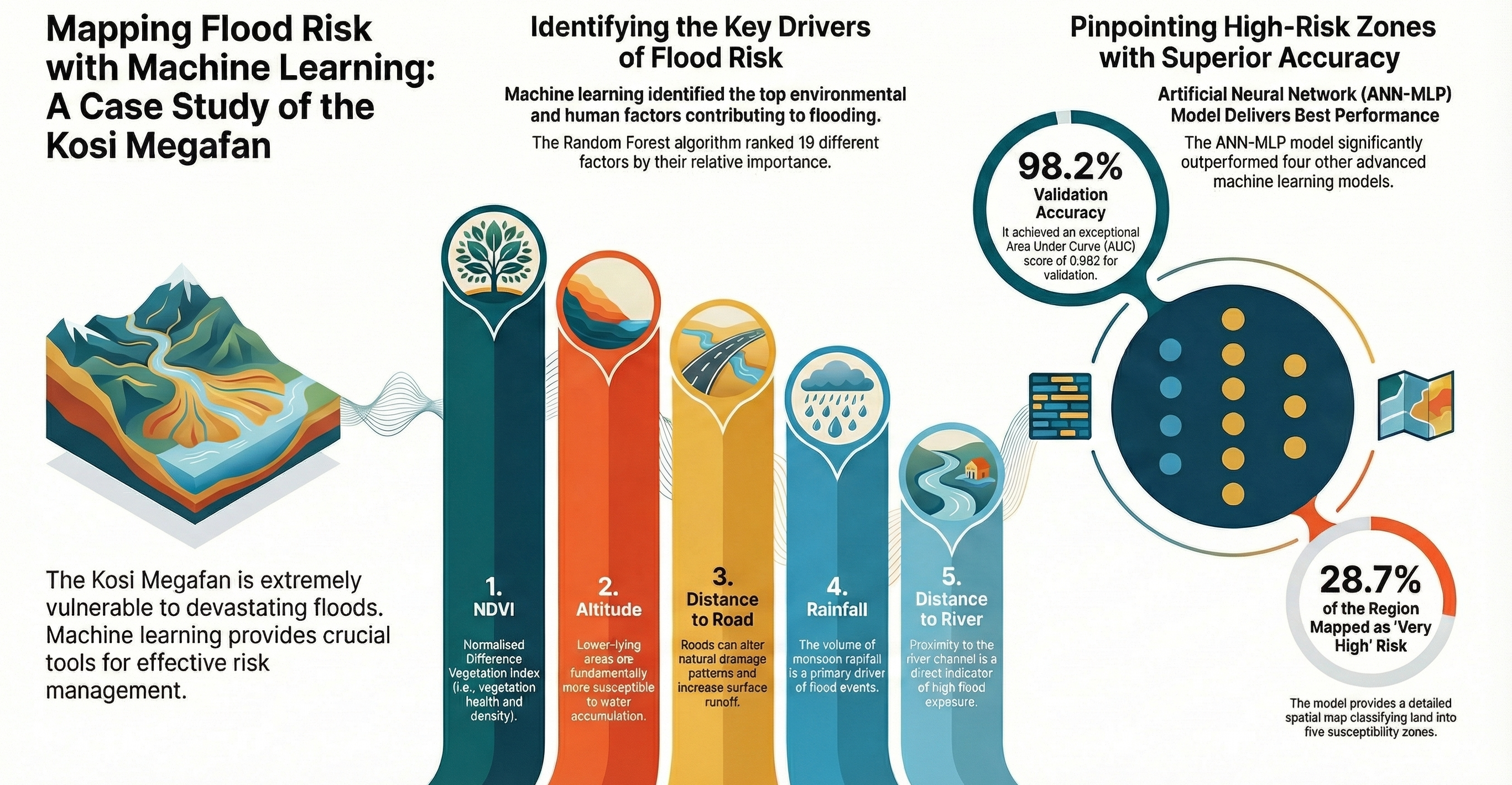
Flood Risk: Kosi Megafan
Scientific Reports (2025): ANN-MLP model delivering 98.2% accuracy in identifying flood susceptibility zones in the Himalayan foreland basin.
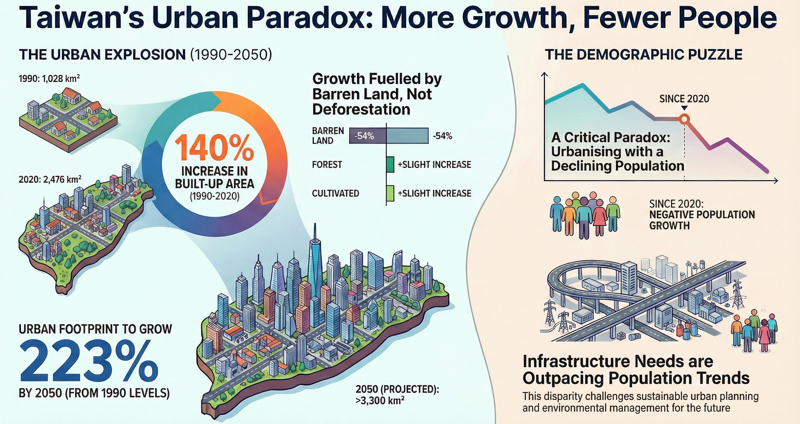
Taiwan's Urban Paradox
Visualizing the disconnect between a 140% increase in built-up area and negative population growth. A critical study for sustainable urban planning.
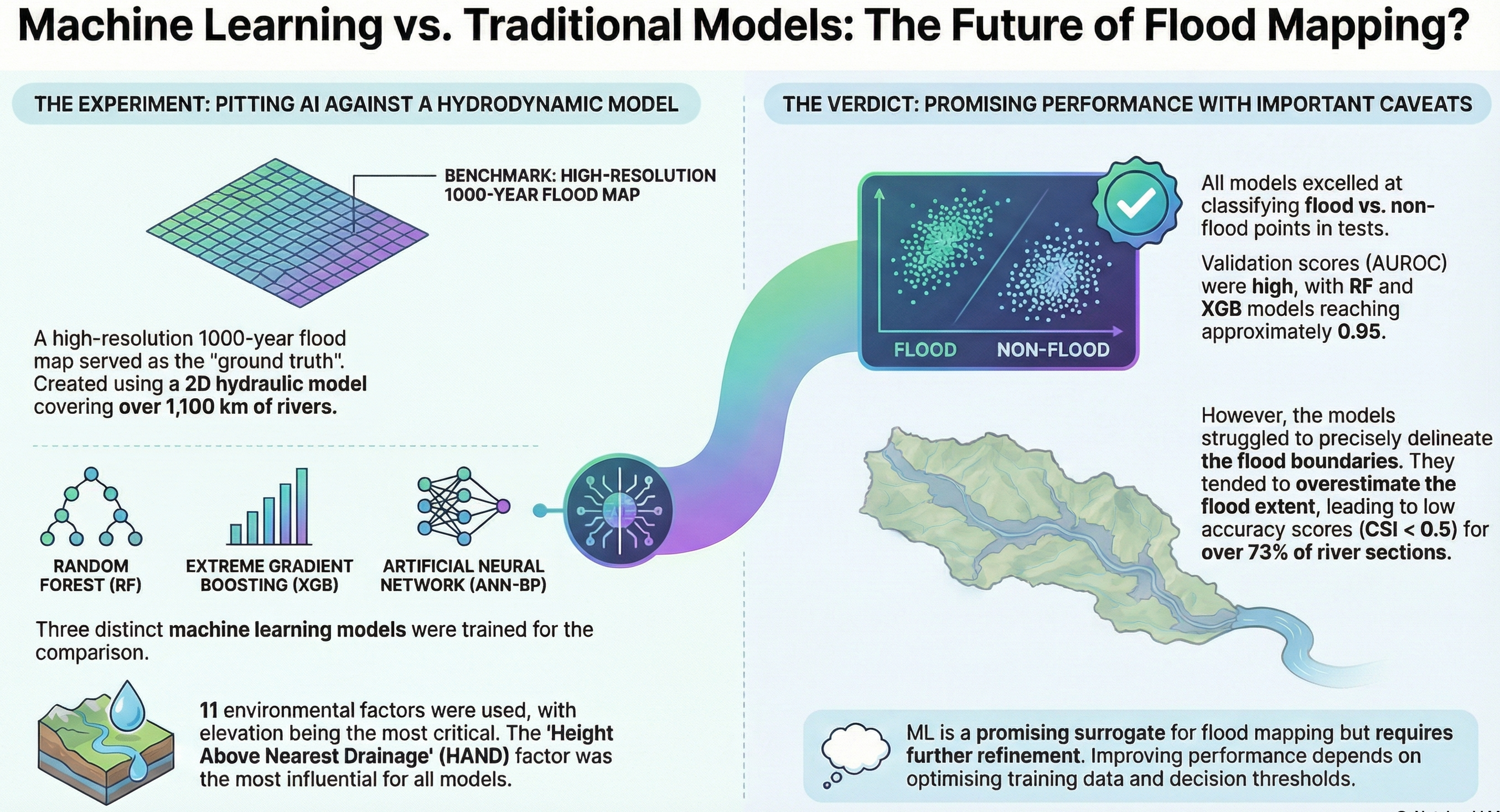
ML vs. Hydrodynamic Models
Validating Machine Learning (RF, XGB) as a surrogate for computationally expensive hydrodynamic flood models in the Argens Basin, France.
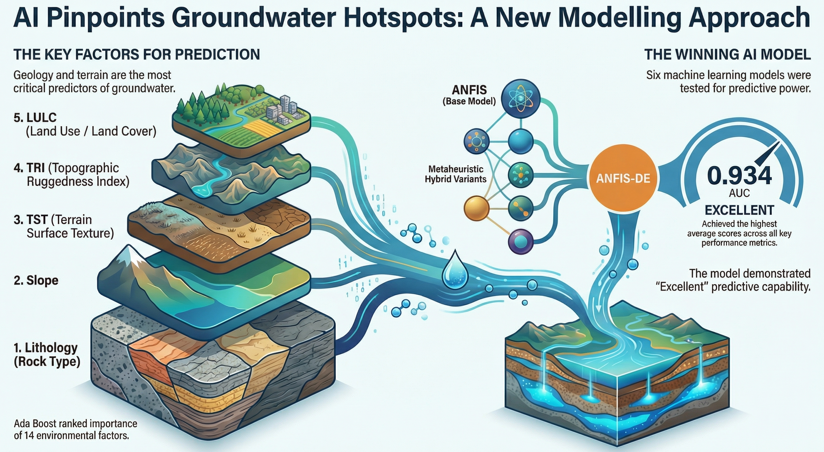
AI for Groundwater
Using ANFIS-DE hybrid models to pinpoint groundwater hotspots based on 14 environmental factors including Lithology and TST.
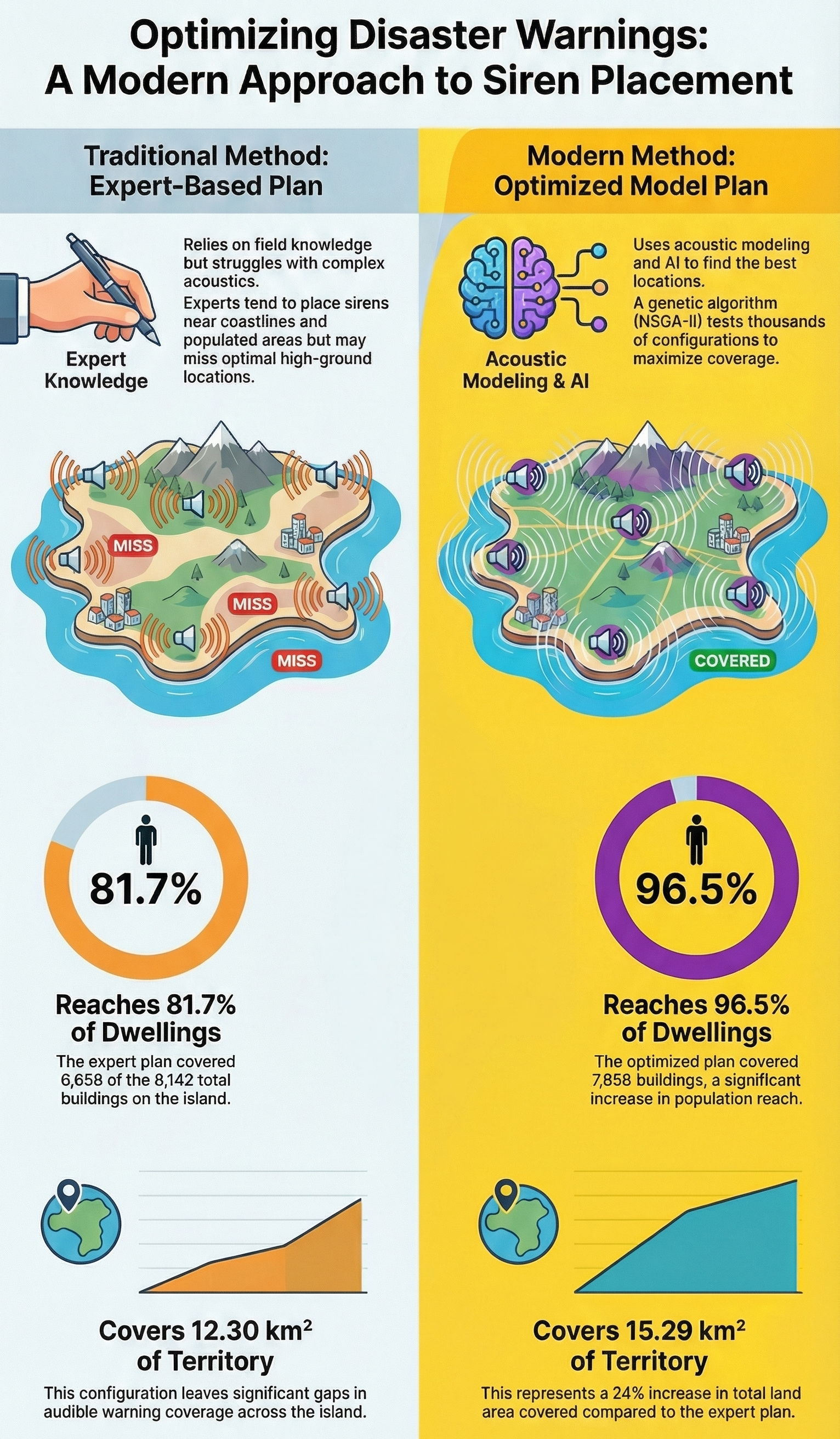
Optimizing Disaster Warnings
A comparison of Traditional Expert-Based planning vs. AI-driven optimization (NSGA-II) for siren placement. The Modern Method increased dwelling coverage from 81.7% to 96.5%.
View Project →